Nature-Based Solutions to Reduce Flooding and Nutrient Runoff in Tavastfjärden Catchment Area
Tavastfjärden is a shallow bay in southern Finland’s southern Baltic Sea coast, whose water quality is affected by agricultural nutrient loading from its catchment area. Flooding of fields increases nutrient runoff, so in winter 2026 almost 800 metres of two-stage ditch and a small wetland were constructed to slow water flow, trap sediments, and reduce nutrient loading. These structures also support biodiversity and improve field conditions by reducing spring flooding and soil loss.
Located in the municipality of Kirkkonummi in southern Finland, Tavastfjärden is a shallow bay that extends far inland and is currently in moderate ecological status based on the classification of the EU’s Water Framework Directive. The Tavastfjärden catchment area is large and diverse, covering 94.82 km². Only one-fifth of the catchment is used for agriculture, but most of the nutrient load entering Tavastfjärden originates from agricultural activities. Due to its high impact on the coastal waters in the region, this area was chosen as a pilot for developing and testing the WSSP operational model in finding high-risk areas for loading and determining suitable water management. The success of the measures will be followed up through monitoring of changes in water quality before and after implementation.
Two‑stage ditches help to reduce the nutrient load entering the rivers and the Baltic Sea
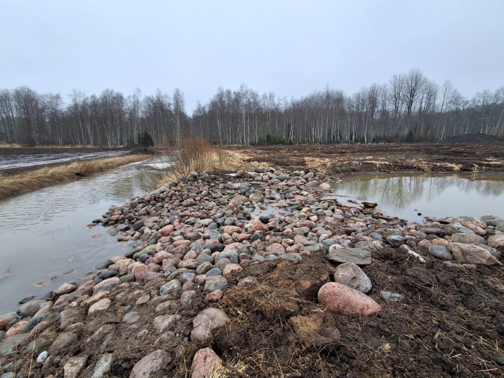
Jolkby is an agriculture‑dominated area within the Tavastfjärden catchment area. The Jolkbyån River and several ditches flowing into it are prone to flooding and are surrounded by fields. Flooding increases the amount of nutrients entering water bodies and creates challenges for cultivating the fields. In the winter of 2026, we constructed a two‑stage ditch along almost 800 metres of the Jolkbyån River and the Torpängen tributary that flows into it.
A two‑stage ditch includes a floodplain terrace excavated along one or both sides of the original channel, where diverse vegetation can grow. During low‑flow conditions, water remains in the original channel, but during high flows it spreads onto the floodplain terrace, where the vegetation slows down the flow and filters soil particles carried by the water. The plants also take up nutrients transported by the water, and when the floodplain terrace is mown regularly, these nutrients are removed from the water system. In addition to improving water protection, two‑stage ditches increase biodiversity in the area and provide varied habitats for many species.
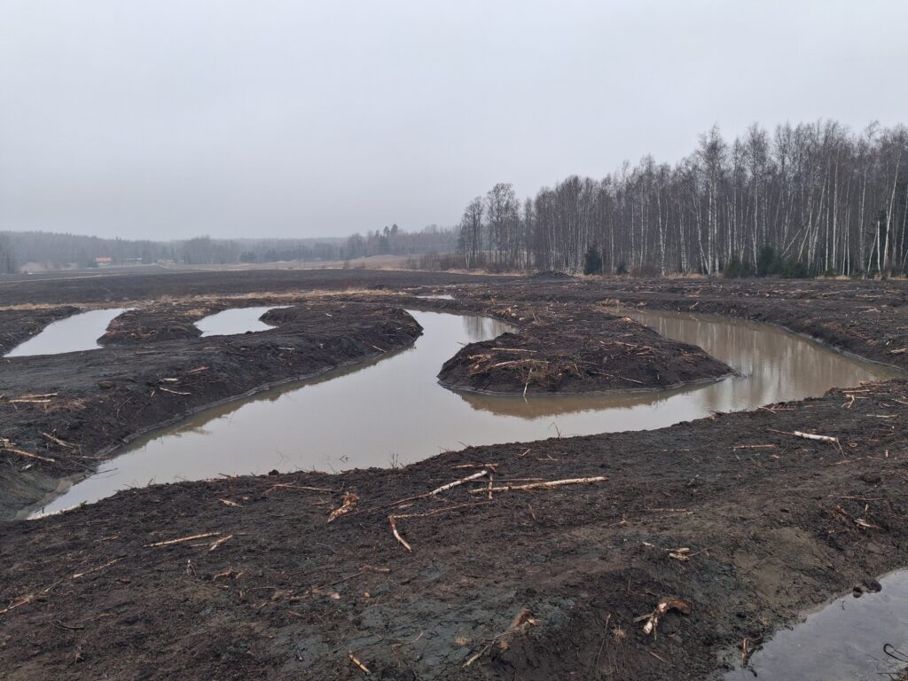
The new wetland filters floodwaters
In addition to the two‑stage ditch, we built a small wetland near Jolkbyån River, where floodwater is directed to flow in a winding, snake‑like pattern. The longer, meandering route slows down the flow, allowing soil particles carried by the floodwater to settle into deep basins excavated at the bottom of the wetland. The accumulated sediment in these basins can be removed periodically, which also removes the nutrients bound to the soil particles from the water bodies.
Cooperation is the key to success
Two‑stage ditches and wetlands are created in cooperation with landowners and farmers, as they often also improve the cultivability of nearby fields. When snowmelt no longer floods the fields in spring, the growing season can begin earlier. In addition, floodwater no longer washes soil and nutrients from the fields; instead, they remain available for plant growth.
These methods can help to decrease the amount of nutrient load ending up in the Baltic Sea and therefore slow down the excessive enrichment of water with nutrients, which can accelerate the occurrence of massive blue-green algae blooms.
About the project
Improving water management with a watershed-based operational model in the Central Baltic Sea area
The Baltic Sea is one of the world’s most sensitive and polluted seas. About half of the nutrient load in the Baltic Sea comes from diffuse pollution, which accumulates for example from urban areas, agriculture, and forestry. The WSSP project promotes a practical and resource-wise Watershed Safety Plan (WSSP) operational model that enables municipalities, water utilities and other relevant actors to reduce the amount of diffuse pollution from reaching the Baltic Sea.